Close-ups
Framed and on the wall
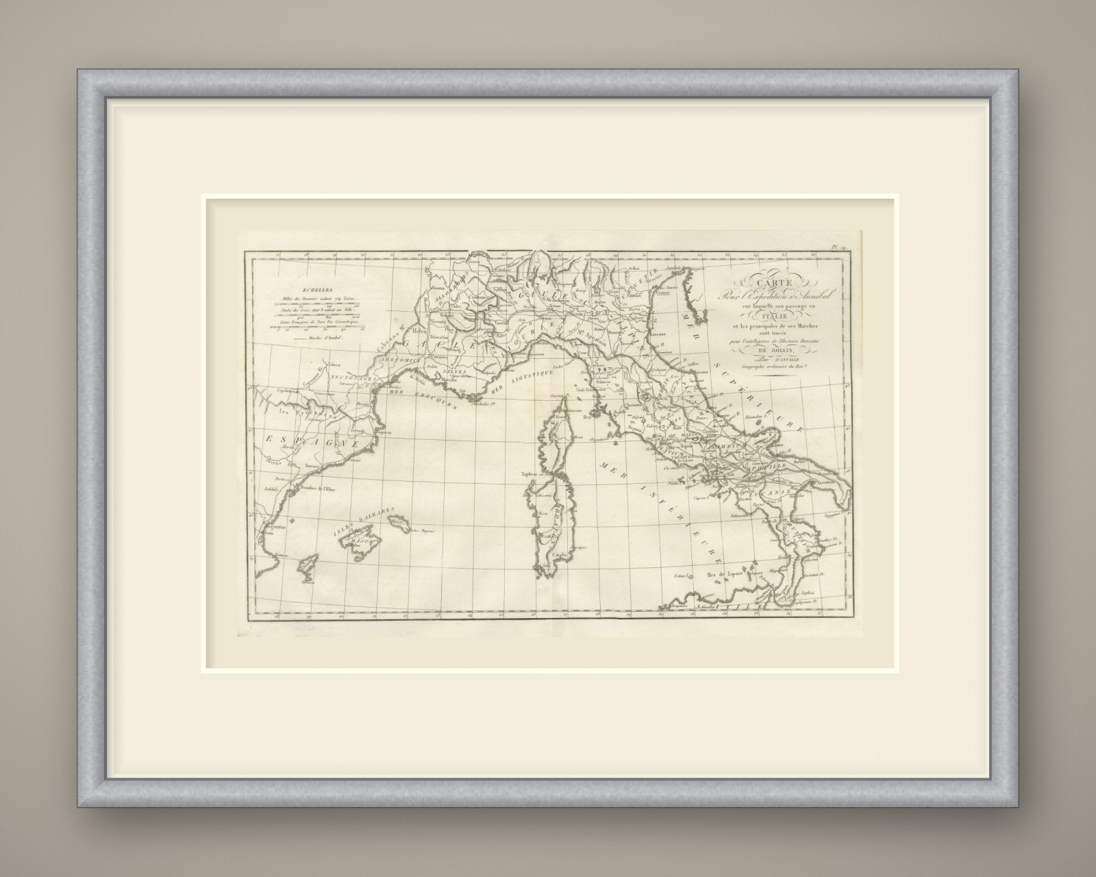

Frame and rooms are illustrations of how the piece could look; it is sold unframed unless the description says otherwise.
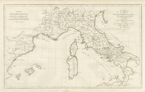
Hannibal's March into Italy, d'Anville Map for Rollin's Roman History, 1818
€285
$320 · £240
Original print, not a reproduction.
Ships worldwide from the Netherlands, flat or rolled, insured and tracked. 14-day returns.
- Date
- 1818
- Technique
- Copper Engraving
- Coloring
- Uncolored
- Condition
- Good. Light uneven toning, browner toward the edges. Marked handling soiling along the bottom and top edges. Foxing over much of the margin. Slight wear at the top right corner. Minor edge wear, shallow nicks along the bottom and right. Center fold as issued.
- Collection
- Campaign maps
- Era
- 1816 to 1899, Empire and industry
- Stock no.
- BG-14399-19
What the condition grades mean
- Excellent
- Bright and clean, with no faults worth mentioning.
- Very good
- Only light signs of age, such as faint toning.
- Good
- Normal signs of age for a sheet of this period: toning, some foxing, small marks or neat old repairs.
- Fair
- Clear faults such as staining, tears or repairs, priced to match.
Every fault we see is written in the condition note, and the whole sheet is shown uncropped in the photos.
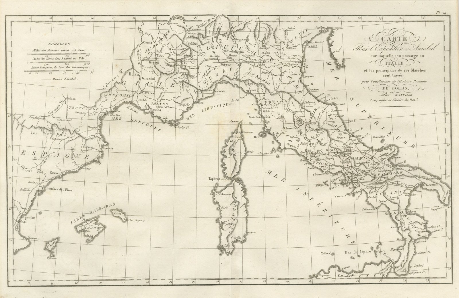
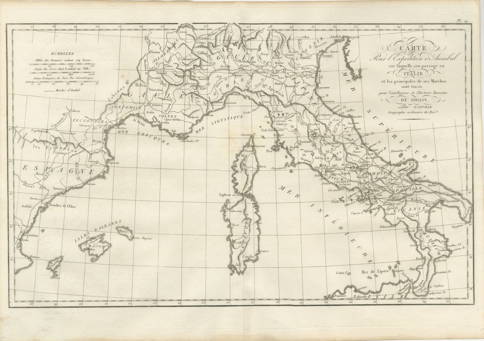
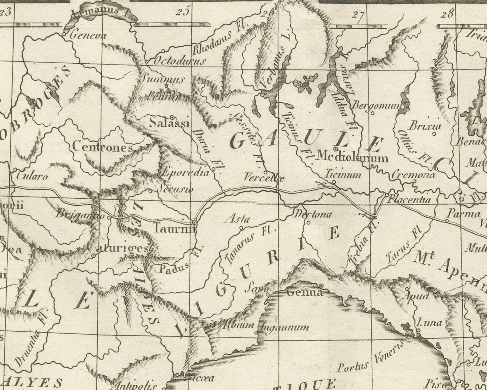
An original copper engraved map, uncolored, from the 1818 Paris atlas made for the works of Charles Rollin. It covers the western Mediterranean from the east coast of Spain across southern Gaul to the whole of Italy, with Corsica, Sardinia, the Balearic Islands and the north coast of Sicily. A double ruled line, keyed at upper left, traces Hannibal's marches. Saguntus, Tarraco, Barcino and the Bouches de l'Ebre mark the Spanish coast; Tolosa, Massilia and Arelate stand in Gaul; Mediolanum, Ticinum, Placentia, Bononia, Genua, Ravenna, Capua, Nola and Tarentum are placed in Italy. The seas are lettered Mer Ligustique, Mer Supérieure and Mer Inférieure, and the Iles de Lipare lie off Sicily.
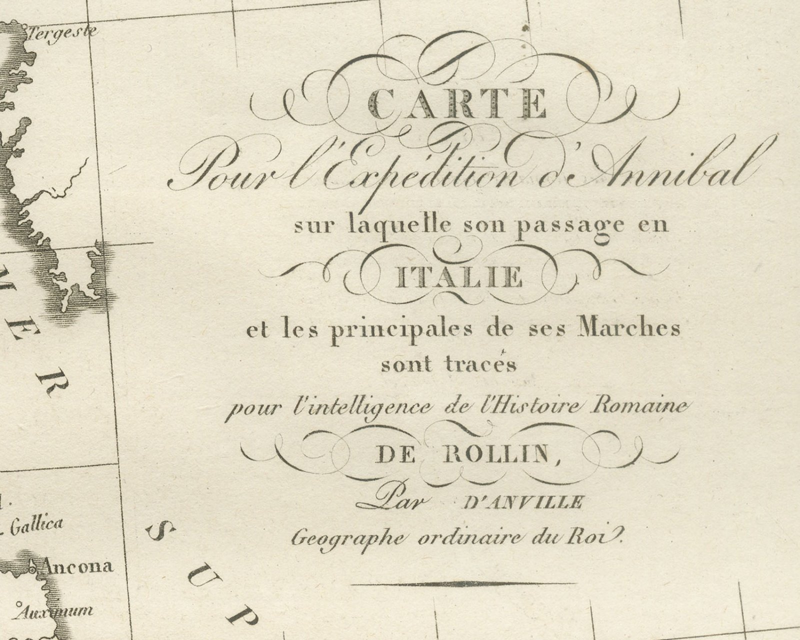
The title cartouche at upper right reads Carte / Pour l'Expédition d'Annibal / sur laquelle son passage en / Italie / et les principales de ses Marches / sont tracés / pour l'intelligence de l'Histoire Romaine / de Rollin, / Par d'Anville / Geographe ordinaire du Roi. The plate number Pl. 19 is engraved above the upper right corner of the neatline. At upper left a block headed Echelles gives three scale bars, Milles des Romains valant 754 Toises, Stades des Grecs, dont 8 valent un Mille and Lieues Françaises, de 3000 Pas Géometriques, followed by the key line Marches d'Annibal.
The plate belongs to the Atlas de Géographie Ancienne, published in Paris in 1818 by Ledoux et Tenré and printed by Didot le jeune to accompany the works of Charles Rollin (1661 to 1741), author of the Histoire ancienne and the Histoire romaine. Its maps were engraved after the originals of Jean-Baptiste Bourguignon d'Anville (1697 to 1782). In the signed foreword Ambroise Tardieu, géographe-graveur, states that the maps were copied with religious fidelity and that, charged with revising the proofs, he had only to correct negligences and faults of execution. Hannibal's expedition belongs to the Second Punic War, when the Carthaginian general led his army from Spain over the Alps into Italy.
Condition: Light uneven toning, browner toward the edges. Marked handling soiling along the bottom and top edges. Foxing over much of the margin. Slight wear at the top right corner. Minor edge wear, shallow nicks along the bottom and right. Center fold as issued.
This is an original antique map, not a modern reproduction. This item is sold unframed. Any framed or interior images are shown for presentation and inspiration only, unless the listing explicitly states that the item is sold framed.
EXPLORE