Close-ups
Framed and on the wall

Frame and rooms are illustrations of how the piece could look; it is sold unframed unless the description says otherwise.
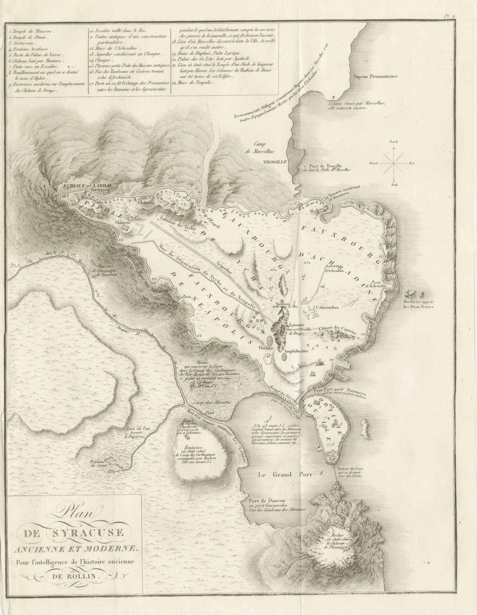
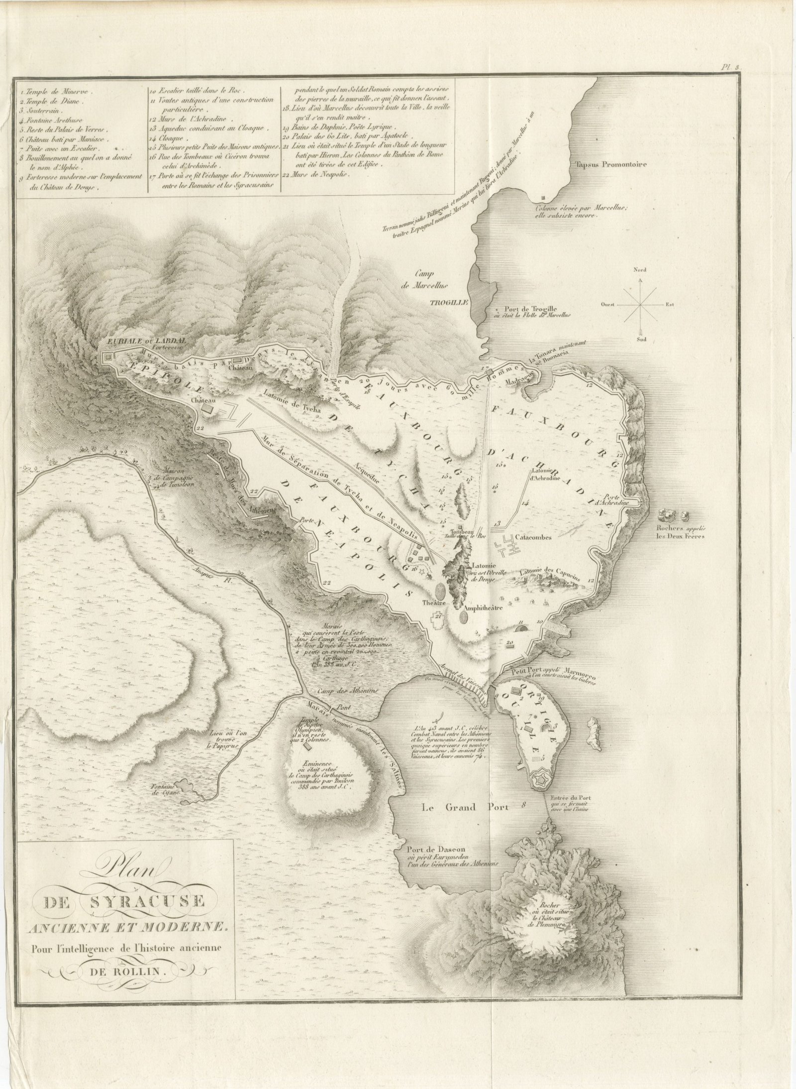
Plan of Ancient and Modern Syracuse with Numbered Key, Rollin Atlas, 1818
£250
$330 · €295
Original print, not a reproduction.
Ships worldwide from the Netherlands, flat or rolled, insured and tracked. 14-day returns.
- Date
- 1818
- Technique
- Copper Engraving
- Coloring
- Uncolored
- Condition
- Good. Light uneven toning, browner toward the edges. Marked handling soiling along the top edge. Foxing over much of the margin. Slight wear at the bottom left corner. Minor edge wear, shallow nicks along the left. Several larger brown marks. A vertical fold runs the full height of the sheet.
- Collection
- Sieges & fortresses
- Era
- 1816 to 1899, Empire and industry
- Stock no.
- BG-14399-8
What the condition grades mean
- Excellent
- Bright and clean, with no faults worth mentioning.
- Very good
- Only light signs of age, such as faint toning.
- Good
- Normal signs of age for a sheet of this period: toning, some foxing, small marks or neat old repairs.
- Fair
- Clear faults such as staining, tears or repairs, priced to match.
Every fault we see is written in the condition note, and the whole sheet is shown uncropped in the photos.
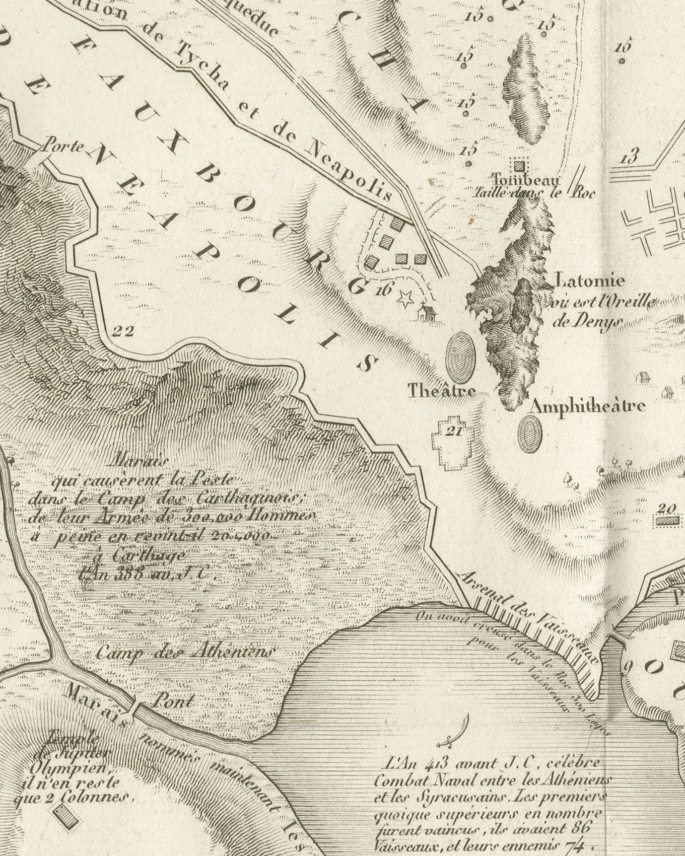
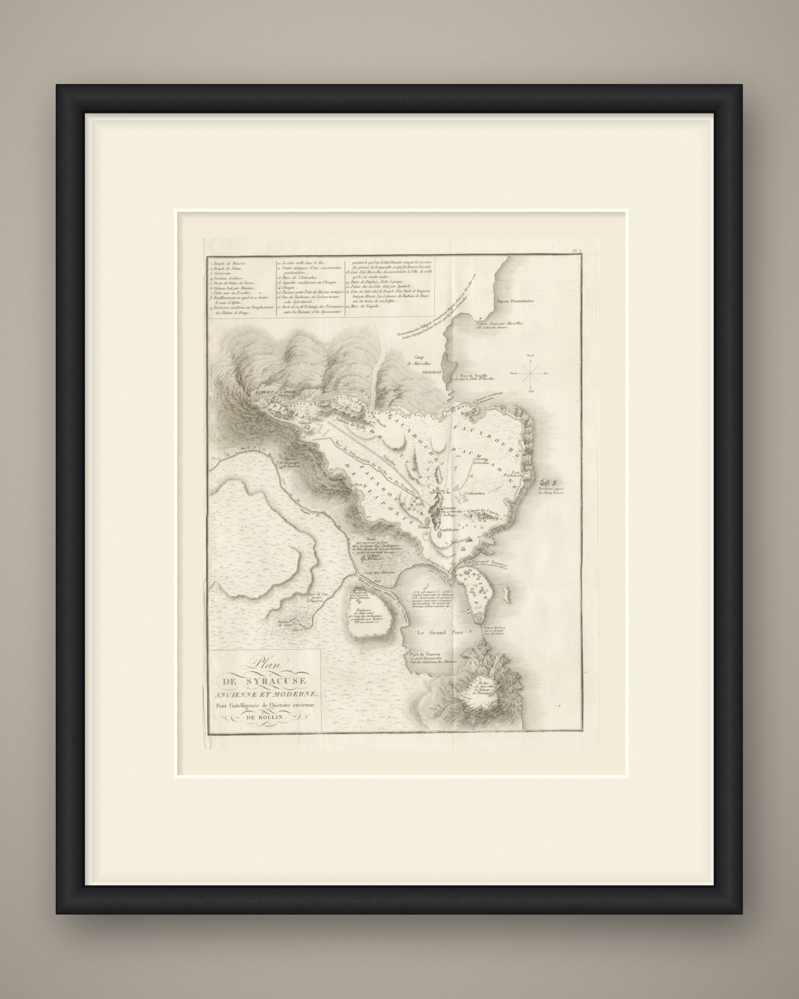
An original copper engraved plan, uncolored, of Syracuse ancient and modern, with the hills drawn in fine hachure. The quarters are lettered Fauxbourg d'Achradine, Fauxbourg de Tycha and Fauxbourg de Neapolis, with the island quarter Ortigie between the Petit Port and Le Grand Port, and Epipole and the fortress of Euriale ou Labdal on the ridge to the west. The walls are lettered as built by Denys le Tyran in 20 days with 60 thousand men. The Théâtre, Amphithéâtre, Catacombes and Latomie are marked, with the Camp de Marcellus, the Camp des Athéniens and the Fontaine de Cyane. A note in the Grand Port records the naval battle of 413 before Christ, in which the Athenians with 86 ships were beaten by the Syracusans with 74.
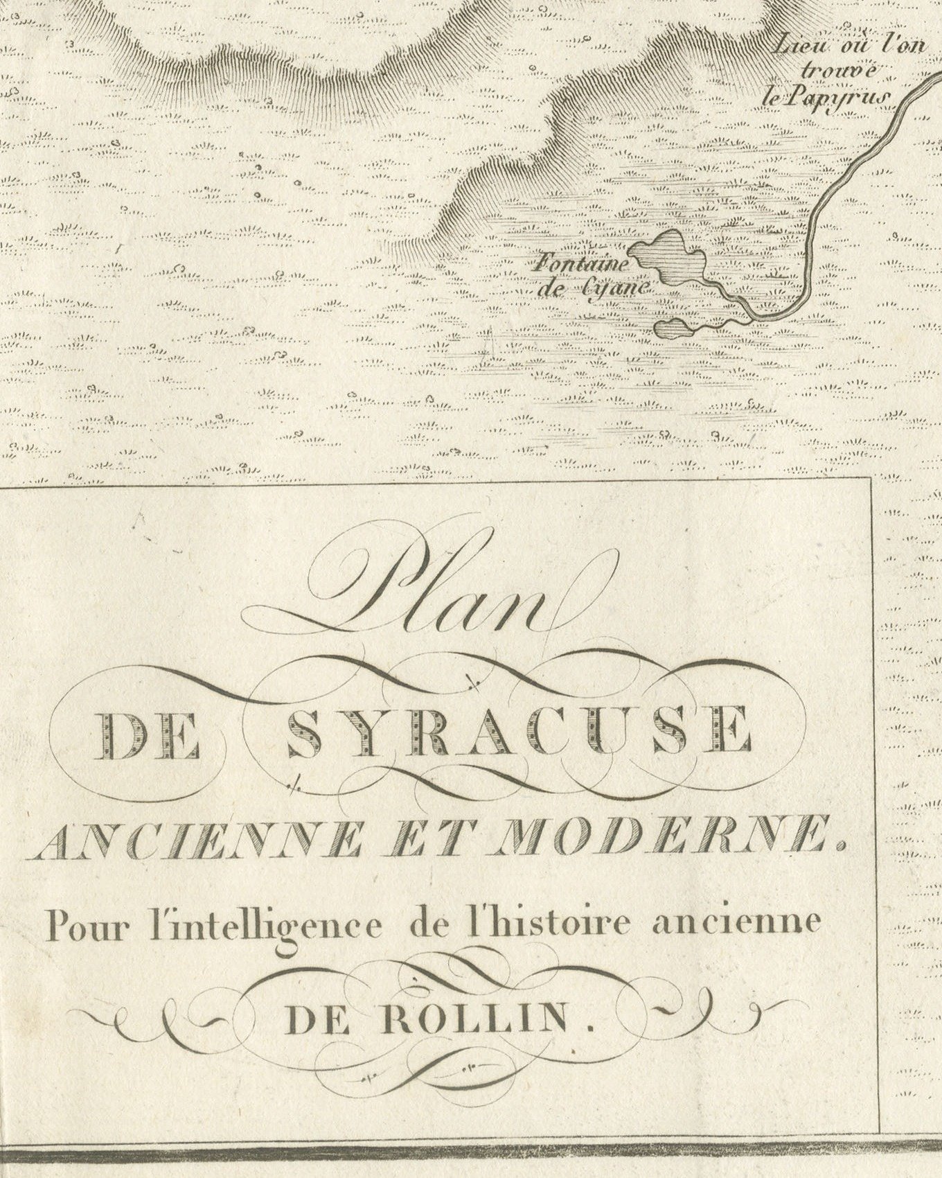
The cartouche at lower left reads Plan de Syracuse ancienne et moderne. Pour l'intelligence de l'histoire ancienne de Rollin. The plate is numbered Pl. 8. above the upper right corner. A ruled key at upper left lists 22 numbered places, from Temple de Minerve to Murs de Neapolis, among them Rue des Tombeaux où Cicéron trouva celui d'Archimède. A compass rose stands at the right. There is no scale bar, and neither author nor engraver is named on the sheet.
The plate comes from the Atlas de Géographie Ancienne, published in Paris in 1818 by Ledoux et Tenré and printed by Didot le jeune to accompany the works of Charles Rollin (1661 to 1741), the French historian whose Histoire ancienne the map was drawn to illustrate. The title page states that the atlas was engraved after the original maps of Jean-Baptiste Bourguignon d'Anville (1697 to 1782). Its table of plates carries a foreword signed by Ambroise Tardieu, géographe-graveur, who writes that the maps were copied with religious fidelity and that, charged with reviewing the proofs, he had only negligences and defects of execution to correct. The naval battle noted on the plan belongs to the Athenian expedition against Syracuse in the Peloponnesian War.
Condition: Light uneven toning, browner toward the edges. Marked handling soiling along the top edge. Foxing over much of the margin. Slight wear at the bottom left corner. Minor edge wear, shallow nicks along the left. Several larger brown marks. A vertical fold runs the full height of the sheet.
This is an original antique map, not a modern reproduction. This item is sold unframed. Any framed or interior images are shown for presentation and inspiration only, unless the listing explicitly states that the item is sold framed.
EXPLORE